Weather Storms and Tornadoes: The Science, the Signals, and Why This Topic Is Trending Now
Published: June 22, 2026
Introduction: What “weather storms” and tornadoes actually are
In meteorology, **weather storms** are not a single phenomenon but a broad category of atmospheric events driven by the interaction of warm, moist air, cooler air aloft, and wind patterns that help create rising motion. The result can be thunderstorms, squall lines, tropical systems, and severe convective outbreaks—each with its own signature. A **tornado**, by contrast, is a specific and violent outcome of severe thunderstorms: a rapidly rotating column of air that extends from the base of a thunderstorm cloud to the ground.
A tornado’s life cycle typically begins when thunderstorms develop strong rotating updrafts known as **mesocyclones**. Under the right thermodynamic conditions—often involving significant **wind shear** (changes in wind speed and direction with height)—the rotating structure can intensify and sometimes “tighten” into a tornado. Tornado intensity is commonly classified using the **Enhanced Fujita (EF) Scale**, which estimates damage potential based on observed effects on buildings, trees, and other structures.
Crucially, tornadoes are not random. They require a particular alignment of ingredients:
While tornadoes are most often discussed in places like the central United States (often referred to as “Tornado Alley”), they can occur across many regions globally, including parts of Europe, Asia, Africa, and Australia. The common thread is atmospheric physics; the different geography mainly changes how often those ingredients align.
The Catalyst: Why this topic is trending right now
Weather storms and tornadoes have become a high-salience topic recently because several reinforcing factors are converging:
1. **More severe outbreak coverage in real time.** Social platforms and live local broadcasting have increased the visibility of tornado warnings and storm footage. When storms are captured with high fidelity—satellite loops, radar overlays, and eyewitness video—public attention spikes rapidly.
2. **Forecast “alerting” is getting better and, therefore, more scrutinized.** Modern warning systems have improved lead times and localization. That means more people receive alerts—sometimes earlier than expected—and consequently more people debate whether alerts are “accurate” when they don’t lead to confirmed tornado damage.
3. **Institutional focus on resilience and adaptation.** Governments and utilities increasingly treat extreme weather preparedness as critical infrastructure policy: stormwater systems, grid hardening, emergency communications, and building codes. When a particularly destructive set of storms occurs—or when a region repeatedly experiences damaging severe weather—political and budgetary attention intensifies.
4. **Climate conversation intersects with storm impacts.** Public discussion increasingly connects tornado impacts to broader climate variability and warming. Even when tornado frequency is difficult to measure precisely at global scales, the reality of damaging events and the uncertainty around attribution are driving more searches, more questions, and more media coverage.
In short, tornadoes are trending not simply because storms are more dramatic in footage—but because **warnings, data, and policy debates** are colliding in a way that makes the topic impossible to ignore.
Deep Dive: Analytical context, history, and second-order implications
A short history of how humans learned to predict tornadoes
For much of modern history, tornado forecasting was limited by observation. Tornadoes were often identified after the damage occurred. Over time, meteorology advanced through:
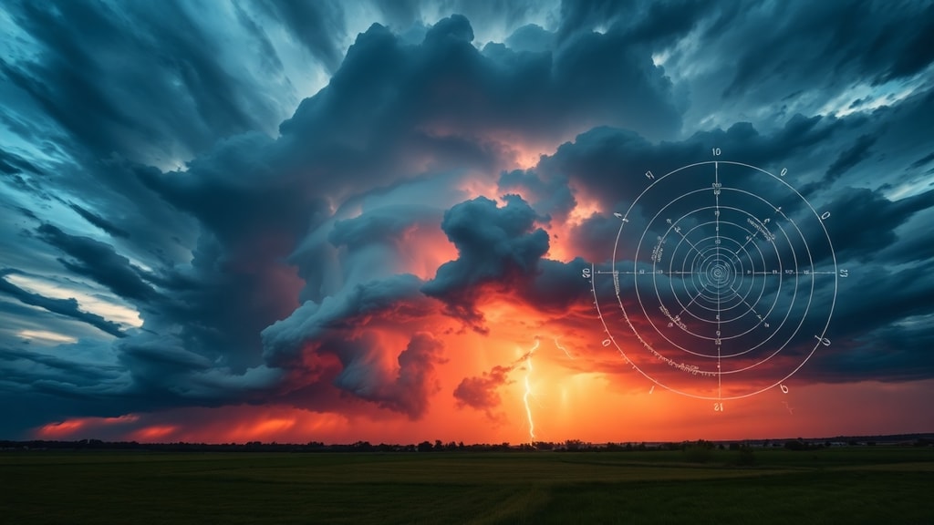
The breakthrough moment was **Doppler radar**: it allowed forecasters to see rotation and interpret storm structure more directly. Later, automated algorithms and decision-support systems improved consistency and response speed.
What changed recently: from radar images to actionable intelligence
In the last decade, operations have shifted from “watching radar” to “interpreting radar as decision inputs.” Forecast centers now use multi-source information—radar, satellite imagery, lightning detection, numerical weather prediction (NWP), and local climatology—to generate warnings.
The emerging trend is **machine learning and AI-assisted nowcasting**. These tools do not replace meteorology; they help with pattern recognition at scale. For example, AI systems can be trained to recognize storm features associated with tornadogenesis, such as signatures of rotation and storm morphology. The second-order impact is significant:
The hard part: tornado detection and the uncertainty problem
Even with advanced tools, tornadoes remain difficult to forecast perfectly. The atmosphere is a chaotic system. Small differences in temperature, moisture, or wind profiles can mean the difference between a rotating storm that produces no tornado and one that yields significant damage.
Moreover, confirmation depends on post-event surveys, damage mapping, and sometimes mobile verification. That creates a communication challenge: during fast-moving emergencies, officials must balance uncertainty against urgency. Misalignment between public expectation (“If you saw it, you must know it”) and meteorological reality (“We can detect signals, but not guarantee outcomes”) can erode trust if not carefully managed.
Second-order implications: infrastructure, insurance, and human behavior
Tornadoes are not only meteorological events—they are economic and social shocks.
1. **Insurance and risk pricing.** As severe weather events accumulate, insurers increasingly model tornado exposure alongside other perils. Building code compliance and mitigation (safe rooms, storm-resistant glazing, roof anchoring) can change premiums and underwriting terms.
2. **Urban planning and the “last mile” of safety.** Tornadoes can strike in rural and suburban areas where warning systems are improving but emergency response capacity may lag. The second-order question becomes: Do communities have a clear, rehearsed plan for sheltering within minutes?
3. **Energy and communications resilience.** Storm damage often knocks out power and cellular networks. When communications fail, even the best warning system can lose its protective value. This is why grid hardening, redundant communications, and disaster-ready logistics increasingly matter.
4. **Public trust in institutions.** Frequent severe-weather alerts can either build trust through consistent performance or harm trust through repeated misses. The trend, therefore, is not only technological—it is also sociological: how communities interpret and act on probabilistic warnings.
The climate question: what we can say responsibly
Any serious discussion must separate two statements:
Even where attribution remains uncertain, the practical takeaway is clear: **extreme weather preparedness is a no-regrets strategy**. Whether tornado risk changes slightly, substantially, or unevenly, the cost of being unprepared is high—and preparedness is measurable and improvable.
Future Outlook: Bob’s forecast for the next decade
My forward-looking prediction is that the next wave of progress in weather storms and tornado protection will come less from a single “breakthrough” device and more from **system integration**: faster sensing, better probabilistic interpretation, and more reliable delivery.
Within the next decade, I expect three changes to dominate:
1. **More granular warnings** that better communicate uncertainty (“tornado possible,” “tornado likely,” “confirmed rotation”) in plain language.
2. **Wider use of AI-assisted nowcasting** inside operational centers, improving the speed with which rotation signals become public action.
3. **Institutionalization of mitigation**—safe-room standards, roof anchoring, municipal shelter mapping, and grid resilience—because repeated storms force policymakers to treat tornado safety like flood safety: essential, not optional.
Tornadoes will never be fully predictable with certainty, but the trajectory of this field is unambiguous: society is building a tighter loop between atmospheric sensing and human protection. When that loop strengthens, fewer storms turn into catastrophes—and that, in the end, is the only forecast that matters.